001
View Case Study
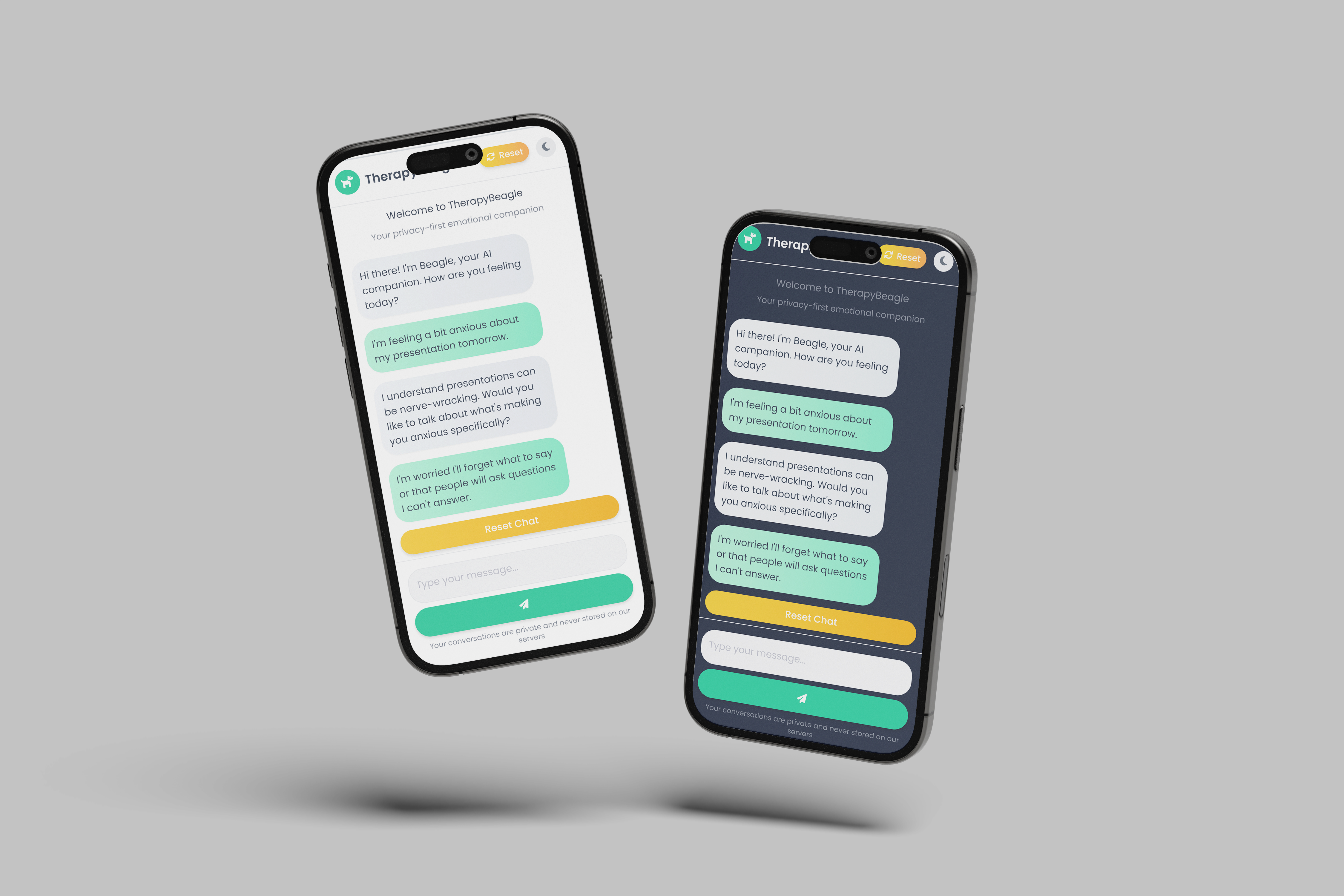
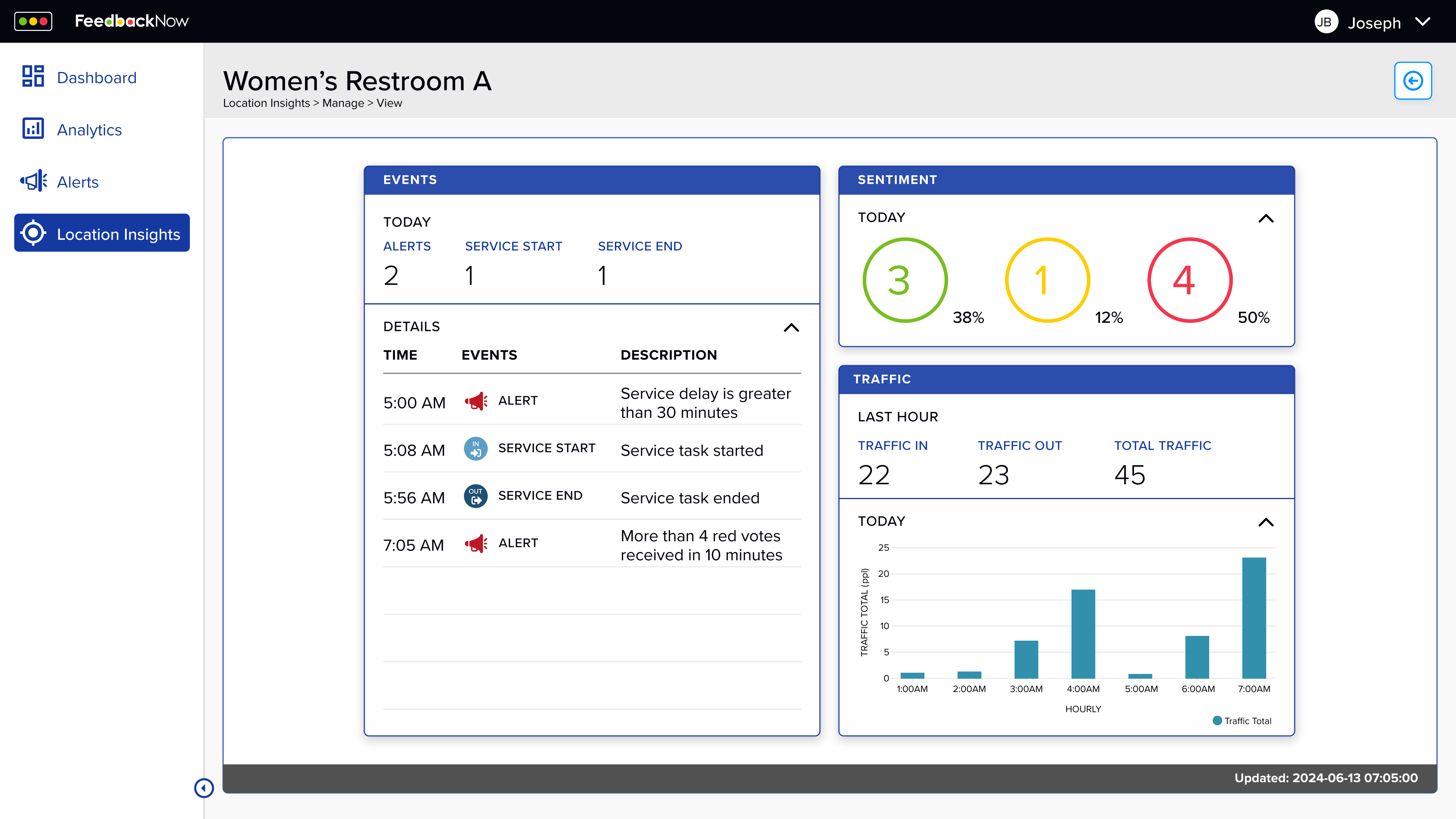
Therapy Beagle
Reimagining AI as a gentle companion
Discipline
Product Design, UX Research, Interaction Design
Focus Areas
AI Ethics, Mental Health, Privacy-First Design
Deliverables
Research Report, Interactive Prototype, Design Guidelines
Designed a mindful AI experience focused on empathy, privacy, and creating space for genuine reflection. This project explores how artificial intelligence can support mental wellness while respecting emotional boundaries and maintaining user agency.
Through research with mental health professionals and extensive user testing, Therapy Beagle demonstrates responsible AI design prioritizing emotional intelligence over algorithmic efficiency, transparency over persuasion, and human dignity over engagement metrics. The project challenges conventional chatbot patterns by designing for care rather than conversation.